Назад Back to services
Urban planning and landscape

Urban planning

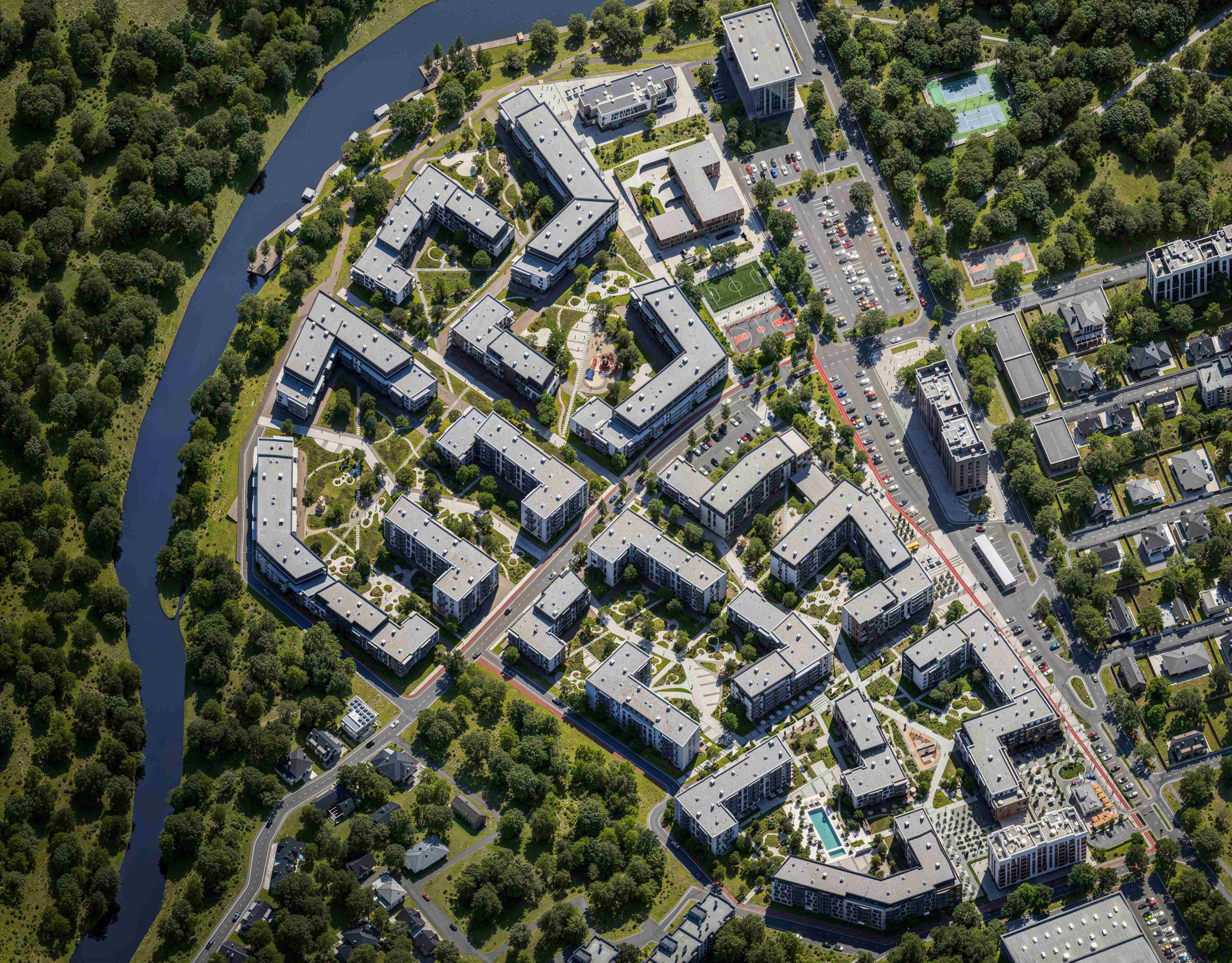
CentralPark з висоти: планувальна структура кварталу біля річки

A detailed territory plan (DPT) is local-level spatial planning documentation that develops the provisions of a settlement's general plan or of a comprehensive plan, and defines the planning organisation and development of a part of the territory: a block, a neighbourhood, or a site intended for comprehensive development or reconstruction.

AIMM works with territories of every scale, from a single block to an entire city. We develop master plans, general and detailed territory plans, zoning projects, and functional-spatial concepts for districts, integrated with the transport, engineering and natural systems of the city.

What a detailed territory plan is for

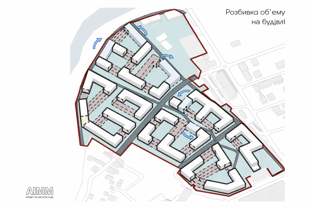
Detailed territory plan of a block: site boundaries, street network and development blocks
A detailed territory plan for a block on a former industrial site: site boundaries in red lines, the street network, development blocks and public spaces. Bureau project, Kyiv.

The detailed plan translates the general provisions of a master or general plan down to a specific site. Without it, comprehensive development of a block can be neither designed nor approved. In practice it is needed to:

  • set the development parameters of a specific block or neighbourhood — density, number of storeys, placement of buildings;
  • establish red lines and building regulation lines;
  • obtain urban planning conditions and restrictions where no zoning plan covers the territory;
  • form new land plots and enter the data about them into the State Land Cadastre;
  • coordinate social infrastructure, utility networks and the transport layout before building design begins.

What the law requires a detailed plan to define

DESIRE complex master plan scheme with site boundaries and numbered explication
A master plan scheme with site boundaries in red lines and a numbered explication: the building being designed, entrance groups, parking, pools and recreation areas. DESIRE complex, Antalya.

The list is set out in article 19 of the Law of Ukraine “On Regulation of Urban Development Activity”. A detailed territory plan defines:

  1. the principles of the planning and spatial organisation of development;
  2. red lines and building regulation lines;
  3. the regime and parameters of development and the distribution of territories in accordance with building codes — within the functional purpose set by the comprehensive or general plan;
  4. urban planning conditions and restrictions where no zoning plan exists, or their refinement where it does;
  5. the need for public service facilities and their location;
  6. the feasibility, scope and sequence of redevelopment;
  7. the sequence and scope of engineering preparation of the territory;
  8. the system of utility networks;
  9. the organisation of vehicle and pedestrian movement;
  10. comprehensive landscaping and greening, and the need to form an ecological network;
  11. the boundaries of coastal protective strips and beach zones of water bodies, where no zoning plan exists.

Two details are easy to miss. A detailed plan defines the planning organisation without changing the functional purpose of the territory — that is set by the comprehensive or general plan. And once approved, detailed plans become an integral part of the general or comprehensive plan rather than standing as separate documents.

What a detailed territory plan contains

The composition is set by DBN B.1.1-14:2021, “Composition and Content of Spatial Planning Documentation at the Local Level”, in force since 1 October 2022. The written part is built from three sections:

  • comprehensive assessment of the territory — existing use, the planning framework, land management and land use, protected and landscape-recreational areas, restrictions on land use, development and economic activity, public services, transport mobility, utilities and landscaping;
  • a long-term development model for the territory;
  • the rationale for the design decisions — functional zoning, projected restrictions, placement of housing, business and industrial facilities, transport and utility infrastructure, formation and registration of land plots, and the implementation plan.

The graphic materials are what the client actually works with afterwards:

  • a location scheme of the territory being planned;
  • a plan of existing land use and a scheme of existing restrictions;
  • the design plan and a scheme of projected restrictions on land use;
  • a transport mobility and infrastructure scheme;
  • a red lines plan;
  • cross-section drawings of the streets;
  • a utilities scheme for the territory;
  • a scheme of engineering preparation, landscaping and vertical planning.

Who develops a detailed plan, and on whose decision

Doha Island functional zoning scheme with uses colour-coded by level
Functional zoning shown by level: parking, yacht club, retail, museum and exhibition spaces, offices, hotel rooms and apartments, each use in its own colour. Doha Island.

A detailed plan is developed on the decision of the relevant village, settlement or city council. The council is the client, while the work may be financed by an interested investor or landowner — a common arrangement in Ukraine.

Under the same article 19, the developer may be an entity entitled to produce spatial planning documentation under the Law “On Architectural Activity” and land management documentation under the Law “On Land Management”. In practice that means a team with certified architects and urban planners — which is also why a detailed plan produced by an architectural bureau differs from one produced purely as paperwork: it is written by people who understand what will later be built there.

Two further requirements are mandatory: a detailed plan is subject to strategic environmental assessment and must go through public consultation. It is approved by a decision of the same council; for territories outside settlement boundaries, by the relevant state administration.

How the process runs

  1. Council decision and brief. The council resolves to commission the detailed plan and approves the design brief.
  2. Input data. Topographic survey, the spatial planning documentation currently in force for the territory, State Land Cadastre records, and restrictions on land use.
  3. Comprehensive assessment. We analyse existing use, the planning framework, transport, utilities, restrictions and regime-forming objects.
  4. Design decisions. Functional zoning, development parameters, red lines, transport and utility schemes, landscaping, formation of land plots.
  5. Assessment and consultation. Strategic environmental assessment and the mandatory public consultation on the draft.
  6. Approval. Review and approval by council decision, after which the detailed plan becomes part of the general or comprehensive plan.

How long it takes

The design work itself is a matter of months rather than weeks. The overall duration, however, is set by the procedure rather than by the drawings: the environmental assessment, public consultation, review by specialised committees and the council's own session schedule. In large cities the approval route can outlast the entire design effort — in Kyiv, in our experience, at least two years are allowed for passing the committees and for the accompanying change of the land plot's designated use.

We therefore quote two separate durations: one for producing the documentation and one for supporting the approvals. That is more honest than a single figure that depends on an authority rather than on the designer.

Detailed plan, general plan and comprehensive plan

The three documents are easy to confuse, although they operate at different levels.

  • The comprehensive spatial development plan of a territorial community covers the whole community. Introduced by Law No. 711-IX of 17 June 2020, it combines the roles of a general plan and a zoning plan across the community's entire territory.
  • The general plan of a settlement covers one city, town or village: the functional purpose of territories, main roads, utility infrastructure.
  • The detailed territory plan covers a part of a territory — a block, a neighbourhood, a site. It develops the two documents above down to development parameters and red lines.

How much a detailed territory plan costs

There is no single price — it is calculated for a specific territory. What drives it:

  • the area of the territory and its boundaries — inside a settlement or beyond it;
  • whether valid spatial planning documentation exists for the territory to build on;
  • the number of restrictions: heritage sites, airport surroundings, coastal strips, regime-forming objects, sanitary zones;
  • the state of the input data — whether a recent topographic survey exists and whether land plots have been formed;
  • the scale of the land management component and the number of plots to be formed;
  • the scope of support: environmental assessment, public consultation, attendance at committees until approval.

To prepare a quote we need the boundaries of the territory, the council decision or the intention to obtain one, the documentation currently in force and whatever input data exists. On that basis we issue a proposal with a scope of work and two durations — for the documentation and for the approvals.

Related services

Territory planning is rarely a standalone task. It is followed by the architectural concept for the individual buildings, then the schematic design and the design documentation. The landscape component and work with open spaces are covered by urban planning and landscape. Completed territories are collected in projects, and the full list of stages is in services.

12
years of practice
481
projects
14
countries

Frequently asked questions

Lets create something together
The highest quality based on experience — The highest quality based on experience — The highest quality based on experience —
Drop
request